The Vanishing Foundation: How Aquifer Depletion Is Quietly Draining America's Rivers From Below
Most Americans picture a river as something visible — a ribbon of water cutting through a landscape, fed by rainfall and snowmelt, shaped by the land it crosses. What far fewer people understand is that a significant portion of what keeps any given river alive during the weeks and months between storms comes not from above, but from below. Groundwater, stored in vast underground formations called aquifers, seeps steadily into riverbeds and streambanks through a process hydrologists call baseflow. It is this slow, invisible contribution that sustains aquatic ecosystems during dry spells, moderates water temperatures, and keeps fish alive when the sky refuses to cooperate.
And across much of the United States, that underground reservoir is disappearing.
What Baseflow Actually Does — and Why Its Loss Is Catastrophic
To understand the stakes, it helps to think of a river not as a single system but as the visible expression of a much larger, mostly hidden hydrological network. During periods of precipitation, surface runoff dominates river flow. But during dry intervals — which, in the context of accelerating climate disruption, are growing longer and more severe — rivers depend almost entirely on groundwater discharging through their banks and beds.
This baseflow contribution is not incidental. In many rivers across the central and western United States, groundwater accounts for more than half of annual streamflow. In some reaches of the High Plains, that figure climbs even higher. When aquifer levels drop, the hydraulic gradient that pushes groundwater toward the river weakens. In extreme cases, the gradient reverses entirely: instead of groundwater feeding the river, the river begins losing water into the depleted aquifer beneath it. Hydrologists call these "losing reaches," and they represent one of the least-discussed drivers of river degradation in the country.
The ecological consequences cascade rapidly. Reduced baseflow means shallower, warmer water — conditions that devastate cold-water fish species, disrupt spawning cycles, and accelerate the growth of harmful algal blooms. Riparian vegetation, adapted to the consistent moisture that groundwater-fed streams provide, begins to retreat. Macroinvertebrate communities — the foundation of river food webs — collapse when the cool, oxygen-rich hyporheic zone (the dynamic interface between groundwater and surface water) is compromised.
The Ogallala Aquifer: A Case Study in Slow-Motion Collapse
No aquifer in the United States illustrates this crisis more starkly than the Ogallala, also known as the High Plains Aquifer. Stretching beneath approximately 174,000 square miles across eight states — from South Dakota to the Texas Panhandle — the Ogallala is one of the largest freshwater aquifers on Earth. It is also one of the most heavily exploited.
Agricultural irrigation, which accounts for roughly 94 percent of groundwater withdrawals from the Ogallala, has drawn down water levels in some areas by more than 150 feet since large-scale pumping began in the mid-twentieth century. In the southern reaches of the aquifer, beneath parts of Kansas, Oklahoma, and Texas, saturated thickness has declined so dramatically that some areas may effectively be depleted within a generation under current extraction rates.
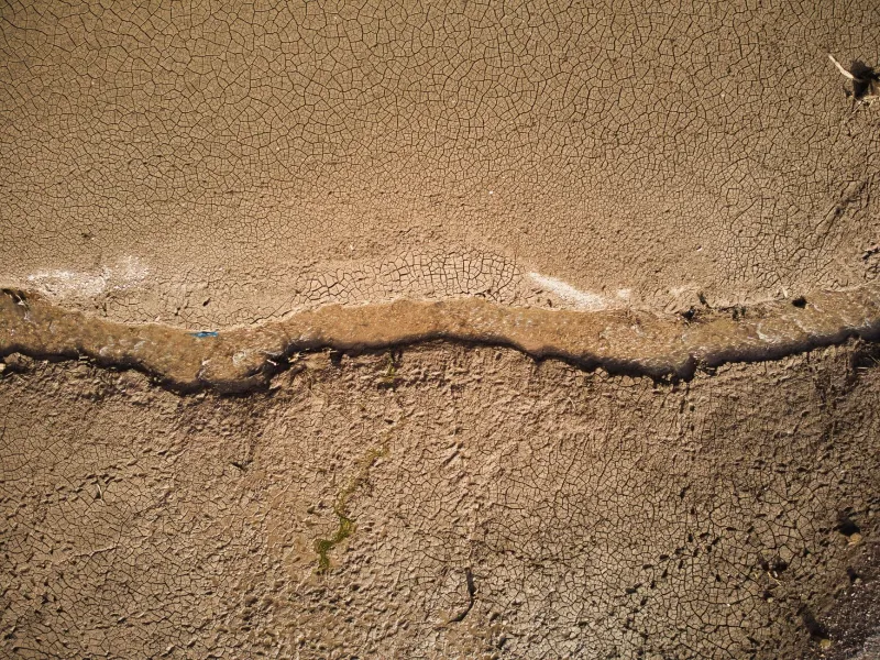
The surface-water consequences are already measurable. Portions of the Republican River in Kansas and Nebraska — once sustained by Ogallala discharge — have experienced significant reductions in baseflow. Stretches of the Cimarron River in the Oklahoma Panhandle have become intermittent, running only after significant rainfall events before retreating into dry, sandy channels. The Arkansas River, which once flowed perennially across the Kansas plains, now runs dry for extended periods in reaches that depended on groundwater contributions now largely exhausted.
"When you remove the groundwater support, you're not just changing the hydrology," explains one hydrogeologist who has studied High Plains stream systems for over two decades. "You're fundamentally altering whether a river exists at all during large portions of the year."
A National Pattern, Not a Regional Anomaly
While the Ogallala commands the most attention, the phenomenon is neither unique to the High Plains nor limited to agricultural regions. In the rapidly growing suburbs of the American Southeast, municipal and industrial groundwater pumping has contributed to declining baseflows in rivers across Georgia, Florida, and the Carolinas. In the arid Southwest, groundwater extraction to support expanding urban populations is drawing down alluvial aquifers that feed stretches of the Rio Grande and its tributaries. Even in traditionally water-rich regions of the Pacific Northwest, localized aquifer stress is affecting seasonal streamflows in ways that compound the pressures already imposed by drought and warming temperatures.
The pattern that emerges from the data is consistent and troubling: where groundwater is extracted faster than it is naturally recharged, rivers suffer — often long before the problem becomes visible to anyone who isn't looking beneath the surface.
The Restoration Blind Spot
This reality exposes a significant gap in how river restoration has traditionally been conceived and funded. The bulk of restoration investment in the United States focuses on surface-level interventions: removing obsolete dams, replanting riparian buffers, reducing point-source pollution, and restructuring channelized stream banks. These efforts are valuable, and the ecological benefits they produce are real. But they cannot compensate for a river that is being slowly drained from below.
Consider the logic: restoring a streambank to support riparian vegetation is a meaningful investment. But if the groundwater table beneath that restored bank continues to fall, the vegetation will eventually struggle regardless of how carefully it was planted. Removing a dam to restore fish passage accomplishes little if the river downstream becomes a seasonal trickle because the aquifer that once sustained its dry-season flows has been pumped to exhaustion.
River restoration, in other words, cannot be decoupled from groundwater management. The two systems are not parallel concerns — they are expressions of the same hydrological reality.
Pathways Toward Integrated Management
Addressing aquifer depletion requires policy frameworks that many states have been slow to adopt. Unlike surface water, which is regulated under a patchwork of state and federal laws, groundwater in much of the United States remains subject to limited oversight. The "rule of capture" — a legal doctrine that historically allowed landowners to pump as much groundwater as they could from beneath their property, regardless of impacts on neighbors or connected surface systems — still governs groundwater use in parts of Texas and other states.
Progress is possible, however, and examples exist. Kansas has implemented Intensive Groundwater Use Control Areas in portions of the Ogallala region, imposing pumping limits in the most critically depleted zones. Several western states have adopted conjunctive management frameworks that formally recognize the connection between groundwater and surface water, treating them as components of a single system rather than separate resources. Managed aquifer recharge programs — which capture surplus surface water during wet periods and direct it underground to replenish depleted formations — are expanding in states from Arizona to California.
At the federal level, conservation programs administered through the U.S. Department of Agriculture offer financial incentives for farmers who voluntarily reduce groundwater consumption through precision irrigation technology or land fallowing agreements. These programs, while underfunded relative to the scale of the problem, represent a meaningful lever that advocates can push to expand.
Seeing the Whole River
River restoration has always required its practitioners to think in systems — to understand that what happens on a hillside two miles away shapes what flows through a streambed today. The groundwater crisis demands that same systemic thinking be extended downward, beneath the riverbed itself, into the saturated formations that have quietly sustained American rivers through every dry season for millennia.
Protecting rivers means protecting the aquifers that feed them. It means advocating for groundwater governance that treats subsurface water not as an inexhaustible private resource but as a shared public trust — one whose depletion carries consequences that ripple upward, quite literally, into every river, every watershed, and every community that depends on flowing water to sustain life.
The river you can see is only part of the story. The part you cannot see may be the part that matters most.