Blind Spots in the Basin: The Crumbling State of America's River Monitoring Infrastructure
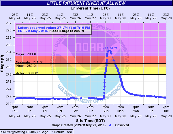
Photo: National Oceanic and Atmospheric Administration, Public domain, via Wikimedia Commons
Somewhere along the Susquehanna River, a sensor that has not transmitted data in three years sits rusting on a concrete piling. Downstream, a municipal water utility draws from the same river, relying on testing protocols that were designed for a different era of industrial activity. This is not an isolated failure. It is a snapshot of a national problem—one that undermines every effort to protect the waterways that sustain American life.
The United States operates what many scientists describe as a patchwork surveillance system for its rivers. Responsibility is divided among federal agencies, state environmental departments, tribal water authorities, and local utilities, each operating under different mandates, budgets, and data standards. The result is a monitoring landscape riddled with inconsistencies—and dangerous blind spots.
The Federal Backbone—and Its Fractures
The U.S. Geological Survey's National Streamflow Network forms the most comprehensive single layer of river monitoring in the country, tracking water levels, flow rates, and, at a subset of stations, basic water quality parameters. At its peak, the network operated more than 8,000 active stream gauges. Budget pressures over the past two decades, however, have forced the decommissioning of hundreds of stations, particularly in rural and lower-income regions where political leverage to preserve funding is limited.
A 2021 analysis by the USGS itself found that approximately 30 percent of watersheds in the contiguous United States lack sufficient streamflow data to support reliable flood forecasting—let alone water quality assessment. When a station goes dark, the data gap it leaves behind is rarely filled by another federal instrument. States are expected to compensate, but their capacity to do so varies enormously.
The Environmental Protection Agency's Clean Water Act framework requires states to assess water quality on a rotating two-year reporting cycle. In practice, many states assess only a fraction of their river miles in any given cycle. A 2022 EPA report acknowledged that fewer than half of the nation's assessed river and stream miles met water quality standards—but also noted that a substantial portion of river miles had never been formally assessed at all. What we do not measure, we cannot protect.
Contamination Events and the Cost of Delayed Detection
The consequences of monitoring gaps are not abstract. When the Dan River in North Carolina was contaminated by a coal ash spill in 2014, downstream communities relied on a patchwork of emergency sampling rather than a functioning real-time alert system. In the years following that disaster, advocates noted that the river had no continuous water quality monitoring at the spill site prior to the event.
Similar stories have unfolded across Appalachia, the Great Plains, and the industrial Midwest. Agricultural drainage carrying elevated nitrate loads can push drinking water sources above safe thresholds within hours of a heavy rain event—yet monitoring schedules built around weekly or monthly grab samples will never capture those spikes. The communities most likely to be harmed are often those with the fewest resources to conduct independent testing.
The economic costs compound quickly. Emergency response to undetected contamination events, litigation, infrastructure remediation, and long-term public health burdens represent a far greater expenditure than the sustained funding of a robust monitoring network would ever require. A 2019 report from the American Rivers organization estimated that for every dollar invested in watershed protection and monitoring, communities realize multiple dollars in avoided costs related to water treatment, flood damage, and public health interventions.
The Inconsistency Problem: Fifty States, Fifty Approaches
Beyond the federal gaps lies a second structural flaw: the absence of standardized protocols across state lines. A river that crosses from Ohio into West Virginia may be tested for entirely different contaminants on either bank, at different frequencies, using different laboratory methods. The data produced by these divergent systems is difficult to compare, difficult to aggregate, and often impossible to use for longitudinal trend analysis.
This inconsistency is not simply a bureaucratic inconvenience. Pollutants do not respect state boundaries. Elevated phosphorus loads originating in Iowa agricultural districts travel downstream through Missouri and into the Mississippi River system. Without coordinated, basin-scale monitoring that bridges jurisdictional divides, the cumulative picture of river health remains perpetually incomplete.
Some interstate compacts and regional water authorities have made progress toward harmonized data standards, but these efforts remain voluntary, underfunded, and geographically uneven. The Great Lakes region has benefited from relatively robust interstate cooperation; much of the rural South and the intermountain West has not.
Community Science: Filling the Gaps from the Ground Up
Into this surveillance vacuum, a growing movement of community-based water monitoring has emerged with remarkable effect. Organizations ranging from small watershed associations to national networks like the Alliance for Aquatic Resource Monitoring (AARM) have trained thousands of volunteer monitors to collect standardized biological and chemical data from rivers and streams that government agencies no longer reach.
These programs do more than generate data. They build the kind of place-based environmental literacy that sustains long-term advocacy. When residents in rural Pennsylvania learn to identify macroinvertebrate communities as biological indicators of stream health, they become informed participants in regulatory processes that would otherwise exclude them. Community monitoring data has been used successfully in Clean Water Act enforcement actions, watershed management plans, and municipal infrastructure decisions.
The challenge is ensuring that volunteer-collected data meets the quality assurance standards required for regulatory use. Several states have developed formal frameworks for integrating citizen science data into official assessments, and the EPA has published guidance on quality assurance for volunteer monitoring programs. Expanding these pathways is essential to realizing the full potential of community-based surveillance.
Technology as a Force Multiplier
Advances in sensor technology and remote monitoring offer perhaps the most transformative opportunity to address the nation's monitoring deficit. Low-cost, solar-powered water quality sensors can now continuously measure parameters including pH, dissolved oxygen, turbidity, conductivity, and nitrate concentration—transmitting data in real time via cellular networks to cloud-based platforms accessible to scientists, regulators, and the public alike.
Several watershed organizations, including groups operating in the Chesapeake Bay region and the Upper Mississippi River basin, have deployed networks of these sensors at a fraction of the cost of traditional monitoring infrastructure. When integrated with satellite remote sensing data and machine learning models trained to detect anomalous patterns, these systems can flag potential contamination events within hours rather than days.
Open-data platforms that aggregate sensor readings from government, academic, and community sources are beginning to emerge, offering the kind of basin-wide situational awareness that current institutional arrangements cannot provide. The technology exists. What remains insufficient is the political will and public investment to deploy it at scale.
A Call for Systemic Investment
Restoring the integrity of America's river monitoring infrastructure is not a luxury—it is a prerequisite for every other water protection goal this nation has set for itself. Clean water standards mean nothing if we lack the instruments to verify whether they are being met. River restoration investments are undermined when we cannot track whether conditions are improving. Communities cannot advocate for their waterways if they have no reliable information about what is flowing through them.
The Clean River Alliance calls for a sustained federal commitment to rebuilding and modernizing the USGS streamflow and water quality network, paired with mandatory harmonization of state monitoring protocols under updated EPA guidance. These investments must be paired with dedicated funding streams for community science programs and open-source sensor deployment in underserved watersheds.
The rivers are still speaking. The question is whether we are listening closely enough to hear them.