Nature's First Line of Defense: The Quiet Erasure of America's Floodplain Buffer Zones
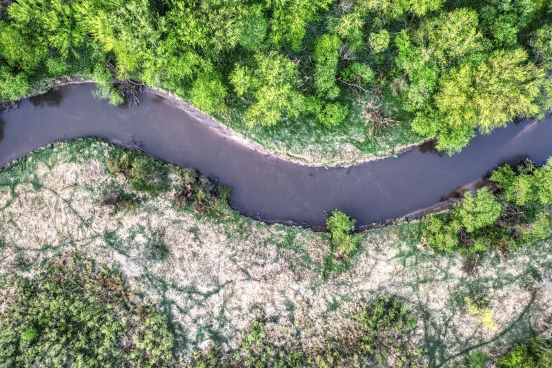
There is a particular kind of loss that arrives slowly, in parcels—a stand of cottonwoods cleared here, a stretch of sedge meadow drained there, a willow thicket graded flat to make way for a corn row or a cul-de-sac. Individually, each clearing can seem inconsequential. Cumulatively, the United States has erased more than 70 percent of its original riparian and floodplain vegetation since European settlement, dismantling what scientists increasingly recognize as some of the most functionally critical ecosystems on the continent.
The consequences of that dismantling are not abstract. They show up in municipal water treatment bills, in the rising cost of flood insurance, in the collapse of fish populations, and in the slow degradation of drinking water sources that millions of Americans depend upon every day. The floodplain buffer—that transitional zone of trees, shrubs, grasses, and wetland plants hugging the margins of rivers and streams—was never simply scenery. It was infrastructure, and its loss carries a price tag that society is only beginning to calculate.
What a Buffer Zone Actually Does
To appreciate the scale of what is disappearing, it helps to understand precisely what intact riparian buffers accomplish. The science here is extensive and unambiguous.
When rainfall saturates upland fields and sends sheets of water cascading toward a river channel, a healthy buffer zone intercepts that flow. Dense root systems slow the water's velocity, allowing sediment to drop out before it reaches the stream. Vegetation takes up excess nitrogen and phosphorus—the primary drivers of algal blooms and hypoxic zones—before those nutrients can enter the waterway. Studies conducted across the Mississippi River Basin have demonstrated that adequately wide riparian buffers can remove between 70 and 90 percent of agricultural nitrogen before it reaches the main channel. That is a filtration capacity no constructed water treatment system can replicate at equivalent cost or scale.
Beyond chemistry, floodplain vegetation performs a critical hydraulic function. Intact floodplains spread and slow floodwaters, storing them temporarily in soils, wetlands, and low-lying vegetation before releasing them gradually. This natural detention reduces peak flood stages downstream, protecting communities and infrastructure. Research from the University of California, Davis, and other institutions has confirmed that every acre of functional floodplain can store anywhere from one to two million gallons of floodwater, depending on soil composition and vegetation density. When those acres are paved, tilled, or compacted, that storage capacity is permanently lost—and the flood pulse that was once absorbed now arrives downstream faster and higher.
Riparian corridors also serve as biological superhighways. The dense, structurally complex vegetation along riverbanks provides nesting habitat for migratory birds, thermal refuge for cold-water fish species during summer warming events, and movement corridors for mammals navigating otherwise fragmented landscapes. The biodiversity supported within these narrow strips is disproportionate to their footprint; riparian zones covering less than five percent of many watershed land areas frequently account for more than half of all terrestrial wildlife species documented within those same watersheds.
The Forces Driving Their Disappearance
The pressures eroding these systems are diverse and deeply embedded in American land use patterns.
Agriculture remains the dominant driver. In the Midwest and Great Plains, the imperative to cultivate every productive acre has pushed row crops to the very edge of drainage ditches and stream channels. Federal crop insurance programs and commodity price supports have historically made it economically rational for farmers to clear riparian margins, since the short-term revenue from an additional strip of corn or soybeans outweighs the diffuse, uncompensated ecological services those margins once provided.
Urban and suburban development exerts its own pressure, particularly in the South and along the coasts. Floodplains are flat, which makes them attractive to developers, and their proximity to water has long been viewed as an amenity rather than a functional constraint. The result is that some of the nation's most ecologically significant river corridors—including stretches of the Chattahoochee, the Sacramento, and the lower Missouri—are now bordered by impervious surfaces that shed water rather than absorb it.
Industrial land uses compound the problem further. Pipeline corridors, utility rights-of-way, and gravel extraction operations frequently bisect riparian zones, fragmenting their continuity and degrading their function even where they are not entirely eliminated.
Counting the Cost
The economic accounting of riparian buffer loss has grown considerably more rigorous in recent years, and the numbers are sobering.
A 2021 analysis published in the journal Nature Sustainability estimated that the ecosystem services provided by intact US wetlands and riparian areas—including flood attenuation, water purification, carbon sequestration, and habitat provision—carry a combined value exceeding $1 trillion annually. The progressive degradation of these systems transfers those costs onto public budgets, municipal utilities, and individual households.
Flood damage provides perhaps the most direct illustration. The Federal Emergency Management Agency estimates that the United States sustains an average of $17 billion in flood losses each year, a figure that has risen steadily as both development in flood-prone areas and the intensity of precipitation events have increased. Research by The Nature Conservancy and others suggests that restoring even a fraction of lost floodplain connectivity could substantially reduce those losses, in some cases generating returns of four to eight dollars in avoided damage for every dollar invested in restoration.
Water quality costs are similarly concrete. Municipalities drawing drinking water from rivers degraded by agricultural runoff spend significantly more on treatment than those served by watersheds with intact riparian vegetation. The city of New York's decision to invest in watershed land protection in the Catskills rather than construct a new filtration plant—a choice that ultimately saved ratepayers an estimated $6 billion—stands as the canonical example of what functional riparian systems are actually worth.
Emerging Policy Pathways
The policy landscape for riparian buffer protection has grown more sophisticated, if not yet commensurate with the scale of the problem.
The Conservation Reserve Program, administered by the US Department of Agriculture, has long offered voluntary payments to farmers who remove highly erodible or environmentally sensitive land from production, including riparian margins. The Inflation Reduction Act of 2022 directed an additional $8.45 billion toward conservation programs, including expanded funding for the Conservation Reserve Enhancement Program, which specifically targets riparian buffers and wetland restoration on agricultural land. Conservation advocates have called for further prioritization of riparian projects within these allocations, arguing that the per-acre ecological return on riparian buffer restoration consistently exceeds that of other enrolled land types.
At the state level, several jurisdictions have moved toward mandatory buffer requirements. Maryland's Forest Conservation Act and the Chesapeake Bay Program's riparian buffer targets represent among the most ambitious state-level frameworks in the country. The Chesapeake Bay Program has committed to restoring 900 miles of riparian forest buffer annually across the six-state watershed—an ambitious benchmark that, if met consistently, would represent a meaningful shift in the trajectory of buffer loss in that region.
Streamside buffer ordinances at the municipal level are also proliferating, though their effectiveness varies considerably depending on enforcement capacity and the breadth of exemptions granted to agricultural operations.
Restoration at Scale
Perhaps the most encouraging development is the growing body of evidence demonstrating that riparian buffers, once conditions allow, can recover with remarkable speed. Passive restoration—simply removing grazing pressure and allowing native vegetation to recolonize—has produced measurable improvements in water quality and channel stability within three to five years in documented case studies from the Driftless Area of Wisconsin and the headwaters of the Chesapeake Bay watershed.
Active restoration, involving the strategic planting of native trees and shrubs, can accelerate that timeline and establish the structural complexity that passive recovery sometimes lacks. Organizations working across the country's river corridors, including Clean River Alliance partners in the Midwest and Southeast, have documented consistent reductions in streambank erosion, sediment loading, and nutrient concentrations at sites where multi-species native plantings were established along previously cleared banks.
The challenge is not technical. The science of riparian restoration is mature, the methods are proven, and the ecological payoff is well-documented. The challenge is scale, funding continuity, and the political will to treat floodplain buffers not as an optional amenity but as essential public infrastructure—as deserving of investment and protection as the levees and treatment plants that attempt, at far greater cost, to compensate for their absence.
America's rivers cannot restore themselves in isolation. They require their margins back. The question is whether the systems of policy, economics, and public understanding will shift quickly enough to give those margins a chance to return.