What Lies Beneath: How American Cities Are Losing Their Grip on Urban Water Systems
Photo: urban stormwater buried stream city infrastructure aerial view, via images.squarespace-cdn.com
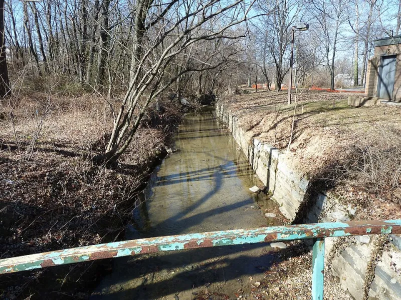
In 2016, workers excavating a site for a mixed-use development in Louisville, Kentucky, broke through a layer of compacted fill and discovered something their project maps had not anticipated: a live, flowing stream, encased in a deteriorating brick culvert, carrying water of unknown origin and quality directly beneath a block of commercial properties. The stream was not entirely unknown to historians—local records from the 1890s documented its name and rough course—but it had vanished from every active municipal database, utility map, and stormwater management plan the city maintained.
Louisville's experience is not exceptional. Across the United States, from legacy industrial cities in the Rust Belt to rapidly expanding Sun Belt metros, a quiet institutional crisis is unfolding beneath the pavement: American cities are losing track of their own water.
The Making of Urban Hydrological Amnesia
To understand how this happens, it is necessary to understand how aggressively mid-twentieth-century urban development remade the American landscape. Between 1950 and 1980, hundreds of cities pursued what planners of the era called stream improvement—a phrase that, in practice, meant enclosing, diverting, or burying any waterway that interfered with road grids, development parcels, or flood-control objectives. Streams were routed into concrete pipes and forgotten. Wetlands were drained and built upon. Floodplains were graded flat and subdivided.
The maps and engineering records documenting these interventions were filed, archived, and—over subsequent decades of staff turnover, departmental reorganization, format changes, and simple neglect—frequently lost. Paper drawings decomposed in flooded basements. Institutional knowledge retired along with the engineers who held it. Digital conversion projects, where they occurred at all, were often incomplete, capturing only the infrastructure deemed most critical.
The result is a kind of enforced ignorance. Many public works departments today can tell you precisely where their water mains run but cannot say with confidence where a buried stream from 1963 was routed, whether that culvert still holds, or what flows through it when it rains.
Why Institutional Fragmentation Makes It Worse
Compounding the records problem is the organizational structure of most American city governments. Urban water systems—stormwater, wastewater, drinking water, floodplain management, and stream corridors—are typically divided among multiple agencies, each with its own databases, budget cycles, and regulatory obligations. A stormwater utility may know about a buried culvert that a parks department does not. A wastewater authority may have records that never migrated to a public works GIS system. State environmental agencies hold permit records that municipalities have never cross-referenced against their own infrastructure inventories.
This fragmentation is not merely inconvenient. It creates genuine public health exposure. In cities where older combined sewer systems intermingle sewage and stormwater in the same pipes, a buried or poorly mapped tributary can serve as an unintended conduit, carrying contaminated overflow into neighborhoods or waterways with no one tracking the pathway. Residents experiencing unexplained basement flooding, persistent odors, or localized sinkholes are often encountering symptoms of a hydrological system that their city government cannot fully explain because it has never fully mapped.
Case Studies in Urban Water Blindness
Cleveland, Ohio sits atop a dense network of buried streams that once drained into the Cuyahoga River and Lake Erie. A 2019 analysis by a regional watershed council found that the city's official stormwater infrastructure maps accounted for less than 60 percent of the buried drainage features identified through a combination of historical aerial photography, LiDAR terrain analysis, and field verification. Several of the unaccounted features were actively conveying water—and in at least two cases, discharging to Lake Erie without any monitoring or treatment oversight.
Houston, Texas offers a different but equally instructive example. The city's explosive growth over the past four decades has frequently outpaced the mapping and regulatory capacity of local drainage authorities. After Hurricane Harvey in 2017, investigators and journalists documented numerous instances in which development had occurred over or adjacent to natural drainage features that had never been formally incorporated into the city's floodplain management framework. The flooding those features produced was, in a technical sense, predictable—had anyone been tracking them.
Philadelphia, Pennsylvania, by contrast, has made meaningful progress through its Green City, Clean Waters program, which has systematically cataloged buried stream reaches across the city's watershed and prioritized several for restoration through a process called daylighting—physically uncovering culverted streams and restoring them to open channels. The program has produced measurable improvements in stormwater management performance, reduced combined sewer overflow volumes, and created green amenities in neighborhoods that had no prior access to waterfront space. Philadelphia's approach demonstrates that the institutional blindness afflicting many cities is not an inevitable condition—it is a solvable problem, given political will and sustained investment.
The Data Tools That Are Changing the Picture
A suite of emerging technologies is beginning to give municipalities new ways to see what lies beneath their streets, even when paper records have long since disappeared.
LiDAR-derived digital elevation models can reveal subtle topographic signatures of buried stream valleys—slight depressions, linear drainage patterns, and remnant floodplain terraces—that remain detectable even beneath decades of fill and pavement. Several states, including Minnesota and North Carolina, have made high-resolution LiDAR data freely available to local governments, enabling watershed councils and university research teams to reconstruct historical stream networks at the metropolitan scale.
Historical map digitization projects, often conducted in partnership with university geography departments or civic technology organizations, are recovering and georeferencing nineteenth and early twentieth-century survey maps, Sanborn fire insurance maps, and USGS topographic sheets that document pre-development drainage in remarkable detail.
Collaborative GIS platforms are enabling, in some cities, the first genuine integration of stormwater, wastewater, and natural waterway data into unified systems that multiple agencies can access and contribute to simultaneously.
None of these tools eliminates the need for field verification. Pipes corrode, routes shift, and historical maps contain their own errors. But together, they are giving cities something they have lacked for decades: a starting point for honest accounting.
The Cost of Continued Ignorance
The stakes of this institutional blindness extend well beyond inconvenience. As climate change intensifies precipitation events across much of the United States, the margin for error in urban stormwater management is shrinking. Cities that do not understand where water naturally wants to go—before it was buried and rerouted—will be consistently surprised by where it ends up when infrastructure fails or storm volumes exceed design capacity.
There are also significant equity dimensions to this problem. Neighborhoods where buried streams and unmapped drainage features are most concentrated tend to be lower-income communities of color, reflecting historical patterns in which flood-prone land was developed last, cheapest, and with the least regulatory oversight. The contamination exposures, flooding risks, and missed restoration opportunities that result from urban water amnesia are not distributed evenly across the metropolitan landscape.
Restoring institutional knowledge of urban water systems is not a romantic exercise in historical recovery. It is a practical prerequisite for building cities that are safer, healthier, and more resilient in the decades ahead. The rivers beneath our streets are not gone. They are simply waiting to be remembered.